
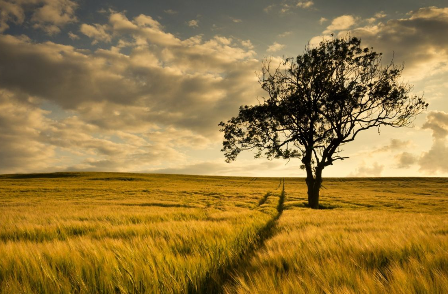
(Cape of Good Hope)
Cape of Good Hope is the landmark of CapeTown, and even CapeTown was built because of Cape of Good Hope, and even the name CapeTown comes from Cape of Good Hope. In the 16th century, traffic between East and West was blocked by the Arabs. In order to acquire Eastern luxuries such as spices, silk and porcelain, European countries sent fleets to find new routes.
The route around the southern tip of Africa is undoubtedly one of the most important, and until the opening of the Suez Canal, it was the only sea route from Europe to Asia, bringing in a lot of money for all countries. The Cape of Good Hope therefore has a special significance in the history of navigation and trade. Even now, giant cargo ships that cannot pass through the Suez Canal still use the route.
The waters around the Cape of Good Hope are the convergence of the Atlantic and Indian oceans, and the huge waves caused by the collision of ocean currents are constant all year round, so the first European to come here, Dias, called this place "Cape of storms."
But around here there is hope to reach the east and acquire wealth, so the king of Portugal renamed it "Cape of Good Hope". Visitors can also take a gondola to the Cape's main peak, where an ancient lighthouse is located.
Standing at the top of the tower, overlooking the lower boundary, the infinite scenery, all in the eyes. Of course, visitors can also walk up the next peak, which also has a lighthouse, and it is newer, to warn ships of the Cape of Good Hope storm.(Ahrabis Falls)
Aurabis Falls is located in the upper reaches of the Orange River (also known as the Gerape River) in the National Park of the same name in the Northern Cape.
The waterfall is 56 meters high, and the best time to visit it is from April to September, avoiding the hot sun in midsummer, and the weather is cool and comfortable to travel. However, the waterfall often flows from February to April, because this is the rainy season of summer.
(Table Mountain)
Table Mountain is a flat-topped mountain in South Africa, 1,087 meters above sea level, standing on the northern end of the high and rocky Cape Peninsula, the top of the mountain can overlook the city of Cape Town and the opposite Table Bay.
The magical Table Mountain is flat as a table top and is known by locals as "God's Table". The Table Mountain range blocks the cold currents, creating a warm and humid climate for Cape Town. Table Mountain is almost surrounded by straight cliffs, and climbing Table Mountain on foot is a very dangerous and hard thing.
You can take a cable car up the mountain. Table Mountain is located in the National park, also called Table Mountain Nature Reserve, the vast area, near the city of Cape Town in the north.
(Penguin Beach)
In the town of Simon, on the east coast of Cape Town, a small bay known as Boulder Park is home to South African penguins, where flocks surf, splash, feed or enjoy the sun on the beach. In 1982, local fishermen found the first two pairs of penguins here, under the spontaneous protection of local residents, after more than 20 years of breeding, now the number of penguins has more than 3,000, and a special penguin reserve has been set up on the beach for penguins to breed and survive.
Visitors can get a closer look through a wood-paneled corridor that plunges down to the beach where the penguins live.
(Pilinsburg National Park)
Pilinsburg National Park, also translated as Bilinsburg National Park, is located in the North West Province of South Africa, around the Sun City, an area of 550 square kilometers, is the fourth largest national park in South Africa, where the animals are completely wild.
Ride into the park in an open jeep driven by a professional hunter and if you are lucky you can spot the famous "five masters of Africa" - elephants, lions, cheetahs, African buffaloes and rhinos. But even if you don't see these large animals, lively antelope, silent wildebeest, graceful giraffes, herds of zebras will make you feel worth the visit.
Book a day and night adventure tour of Pilinsburg at the Sun City Reception Centre Wilderness Adventure counter and take the shuttle bus to the park entrance at the appointed time.
(Mapungubwe cultural landscape)
Mapungubwe lies on the northern border of South Africa, connecting Zimbabwe with Botswana. It is an open savanna landscape formed by the confluence of the Limpopo and Sashe rivers.
It was the largest kingdom on the African subcontinent before it was forgotten in the 14th century. What survives today are the nearly intact ruins of the palace and consequent settlements. And it all shows a picture of social and political development there 400 years ago.