
(Lake Kivu)
It is the highest lake in Central Africa and one of the great lakes in Africa. It is located on the border between the Democratic Republic of the Congo and Rwanda, in the Great Rift Valley of East Africa, west of the Albertine Rift Valley. It was formed by the collapse of a fault.
The shore of the lake is rocky and rugged, and the northern shore has the Nyiragongo volcano, which is 3470 meters high. The lake shoreline is relatively flat in the north, and there are many lake bays in the south. There are many islands in the lake, the largest of which is Igivi Island.
(Rusumo Falls)
Rusumo Falls is a waterfall on the Kagera River, located on the border between Rwanda and Tanzania.
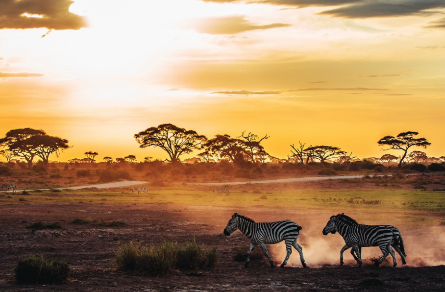
(Kagera National Park)
Kagera National Park is the largest wildlife reserve in Rwanda, located in the northeast of Rwanda, famous for its beautiful scenery, pleasant climate and rare wildlife, is a famous tourist destination in Rwanda. Located near the equator in east-Central Africa, the Republic of Rwanda is a small, mountainous country in Central Africa.
It borders Uganda to the north, Tanzania to the east, Burundi to the south, and Congo to the west. It has been a republic since 1962, gaining independence from Belgium in 1962. Physical geography: The area is 26,338 square kilometers.
The country is divided by huge mountain peaks (up to 3,000 meters high) that span the country from north to south. In the west, the Boangue Volcano rises straight from Lake Kivu, descends first into a hilly central plateau, and then further east around the highlands of the Kagera River to form the marshy lake, which contains the famous Kagera National Park.
The terrain is high in the west and low in the east, mountainous and plateau, and has the reputation of "thousand Qiu country". Central elevation 1400-1800 meters, more rounded low hills. East and south of 1000 meters above sea level, many lakes and swamps.
The highest peak, Karisimbi, is 4507 meters above sea level. The water network is more dense, the Kagera River, Niwarungu River, Lake Kivu and so on. It has a savanna climate. The annual rainfall is 1200-1600 mm. There are tin, tungsten, niobium, tantalum and other minerals. Forests cover about 21% of the country.
(Parc national Tsingy de Bemaraha)
It is a national park of Madagascar, located in the Meraki District in the central west of the country, about 300 kilometers from the capital Antananarivo, covering 723 square kilometers.
(Nosebe Island)
Nosibe Island, located off the northwest coast of Madagascar, is the country's largest coastal island and the country's most famous tourist destination.
(Achin Anana Rainforest)
The Achinanana rainforest is located on the border of Anzilanana and Mahazanga provinces in the northeast corner of Madagascar, with a core protected area of 4796.6 square kilometers.The rainforest is made up of six national parks in the eastern part of the island, and its survival is essential for the continuation of the evolving ecological process, which is necessary to reflect the biodiversity of Madagascar's geological history.
60 million years ago, the island of Madagascar was completely separated from the mainland, and animals and plants began to evolve in isolation.
(Lake Malawi)
Lake Malawi is also known as Lake Nyasa. It is located in the southernmost part of the East African Rift Valley and is the third largest lake in Africa. The lake is 472 m (1,550 ft) above sea level, with a deepest depth of 704 m (2,310 ft) near the northern end.
Lake Malawi is not only a beautiful scenery, but also a variety of beautiful scenery in one, some places surrounded by high cliffs, waves on the shore, and some places have grassland flowing water, especially the northern lake, known as the most magnificent lake and mountain scenery in Central and Southern Africa.