(Wellington)
Also known as the Windy City, is the capital of New Zealand, located in the southwest end of the North Island of New Zealand, with a population of about 450,000, is the main population center in the south of the North Island, and is also the administrative center of the Wellington region.
It is the second largest city in New Zealand and, along with Sydney and Melbourne, is the cultural centre of Oceania. Many artists live or operate here, as well as many art cafes and lively nightlife.
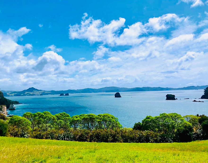
The mountains near Wellington are endless, full of green, blue sea and sky, and the scenery is beautiful. The climate is mild and springlike all year round. Wellington has a mild and humid climate and is a popular tourist destination in the South Pacific.
(Auckland)
Alias sail city, New Zealand's northern coastal city and New Zealand's largest city, an area of 1086 square kilometers, the population of 1.46 million, Auckland has a lot of sailing, known as the "sailing capital", Auckland is the world has the largest number of sailing cities, so also known as the "sailing capital", is the southern Hemisphere's main transportation and shipping hub, It is also one of the major ports in the Southern Hemisphere.
(Queenown)
It is a beautiful town surrounded by the Southern Alps and a beautiful city near the mountains and by the water. Queenstown is a place to visit, with sunny skies in summer, bright red and golden leaves in autumn, clear weather in winter and mountains covered with snow, and flowers in spring.
Four distinct seasons, each has a completely different face. Lake Wakatipu, near the city, is a deep, blue, alpine lake. Several greenish-brown mountains covered with snow dot the background of the magnificent mountain range. From Queenstown to the top of the hill, it is a green color. The name Queenstown comes from the fact that the colonists believed that the beautiful scenery here should belong to the Queen, hence the name Queenstown.
(Mount Eden)
Mt Eden is located about 5 km south of Auckland city centre in New Zealand and is the crater of an extinct volcano. There is a lookout at the top of the hill, which provides a wide view and a good place to enjoy the city view. In addition, you can visit the remains of a Maori fortress from the 12th century.
(Maori village)
Located in the southeast of Rotorua City, adjacent to Whakarewa Geothermal Reserve, the ancient Maori houses have been restored and concentrated here, and there is an exhibition in the center of the village with unique Maori carvings on display, which is the best place for visitors to learn about Maori culture.
Early Maori housing, made of pushgrass and palm branches, simple and low, can not be straight waist. All kinds of storage rooms are supported by high feet, and the tool room is similar to the bamboo tower of the Dai nationality in Yunnan Province, but shorter; The patriarch's pantry, high above the ground, is shaped like a bamboo chair for acrobats. The geyser in the center of the garden, the water column straight jet, more than 30 meters high, like a silver chain shining, white lotus in full bloom.
(Sky Tower)
Built in 1996, it is located at the junction of Victoria Street and Commonwealth Street in the centre of Auckland, New Zealand. The Sky Tower is a sightseeing and radio tower; At 328 meters, the tower is the tallest structure in the Southern Hemisphere.
It is also the thirteenth largest freestanding sightseeing tower in the world and a member of the World High Tower Alliance. The Sky tower can withstand winds of 200km/h and earthquakes of magnitude 7 at 40 km away, and even earthquakes of magnitude 8 at 20 km away will not fall down.(Harbour bridge)
It is a bridge over the Waitemata Harbour in Auckland, New Zealand, and a very representative view. The bridge connects the north and south sides of Waitemata Harbour, Auckland's busiest port, with a total length of 1020 metres.
The bridge was built in 1959, 43 meters above the sea, due to the rapid growth of economy and population there, the design capacity of the bridge has been unable to meet the demand, and in 1969, Japanese experts were hired to design the bridge, the two sides of the bridge widened, from the original design of four lanes to six lanes, so that the bridge's capacity increased by 1 times.
(Mount John Observatory)
Located in the McKenzie region of New Zealand's South Island, it was established by the University of Canterbury and is an important base for space research in New Zealand.